The roadway of this route – Option E – through materials from previously-occurred landslides was partially opened, with the southbound lanes only in operation, in July, 2013. It was fully opened on 7th August of that year.
As occurred at Nerong and has also occurred elsewhere, people’s homes have been severely blasting-damaged and Roads & Maritime Services denies responsibility. Massive water runoff has also damaged property. There is increased noise pollution and vehicle exhaust pollution. The dust from rock-crushing was not wet down. Not only was rock-crushing carried out dry, a rock crusher was moved out of the designated area to above the local public school and surrounding residences just prior to the return of children after their April, 2012, school holidays. Three and a half years after the roadway became fully operational, the township and people’s homes remain contaminated with (but not limited to) deadly, ineradicable silica dust. Airborne crystalline silica (silica dust) is a Group 1 (human) carcinogen; it is the sole cause of the terminal lung disease silicosis and also causes other serious illnesses such as silico-tuburculosis. People dying of silicosis drown in their own blood.
For further facts regarding the ongoing consequences of the use of this dangerous and destructive route read The Aftermath – a Wake of Devastation.
– – – – – – – – – – – – – – – – – – – – – – – – – – – –
At the tiny township of Bulahdelah, on the NSW Mid North Coast, the NSW Roads and Traffic Authority (RTA) [renamed Roads & Maritime Services in 2011] is about to commence construction of an extremely dangerous new section of highway.
Despite the availability of alternatives, including one which has been recorded by the RTA as geotechnically easier, $millions cheaper and, based on traffic-flow alone, the safest for road users, the RTA is hell-bent on using the conglomeration of atrocities initially titled ‘Option E’. It would now cost over to well over $300 million (three hundred million dollars) for the RTA to go ahead with this project.
Due to the urgency of the situation some articles, posts and images from other web sites will be repeated here, with the copyright owners’ permission, in order to get as much information out to the road-using public and others as quickly as possible.
28-10-2009 (Note: as at [17th September, 2010] 5th December, 2010, the situation remains the same to date. This destructive RTA project is so deadly for people in Bulahdelah and so dangerous for road users that it has now been labelled ‘[the RTA’s] $315 million MURDERS’.)
Note 14th November, 2010: A 5th November, 2010, ABC news article involving Mark Clements, CSIRO, contained several fraudulent statements. Two of the lies were concerning [highway] completion time and route location:-
-
That the RTA’s (fraudulently named) ‘Bulahdelah Bypass’ is ‘soon to be completed’ is a lie. [Weather and geotechnical constraints permitting] ‘Major construction activity is expected to last three years‘ Ref: Bulahdelah Upgrading the Pacific Highway Environmental Impact Statement (EIS) Main Volume page 7.57
-
That the ‘route of the highway’ has been ‘altered’ is a lie. The RTA killer route Option E is still being pursued. [The lie that there has been a change of route has been being circulated since (at least) 1st April, 2004, when almost eight months before publication of the EIS, Amanda Fazio MLC lied in Parliament, falsely stating that the route of the Bulahdelah bypass had been changed.
– – – – – – – – – – – – – – – – – – – – – – – –
Completion of the extremely dangerous Bulahdelah Bypass Option E route is not due until 2013. Ref: Australian Government Department of Infrastructure and Transport – Nation Building Program – as updated on 6/6/2011 [screen capture made] – accessed 9th July, 2011.
11-12-2011: Roads and Maritime Services (RMS – previous name: NSW Roads & Traffic Authority, RTA) has recently commenced promulgating a fraudulent completion date for their Bulahdelah conglomeration of atrocities. This is presumably to imply that it’s too late for the dangerous Option E route to be abandoned and the Bulahdelah Bypass diverted to a geotechnically easier, safe route.
The following two images and associated statements are sourced from Save the Alum Sacred Mountain, Bulahdelah (republished with permission, emphasis added):-
 Screen capture of Monday, August 15, 2011, from the Australian Government’s Pacific Highway – Bulahdelah Bypass webpage. Expected Start was 2009 – major construction began in August, 2010. Expected Finish was early 2013 based on a 2009 start which did not happen.
Associated statement from Save the Alum Sacred Mountain, Bulahdelah:-
Australian Government FRAUDULENCE Recorded 11th December, 2011.
From the Australian Government ‘Nation Building’ Pacific Highway – Bulahdelah Bypass webpage snap Monday, 15th August, 2011:-
Expected Start/Finish: December 2009 – Early 2013.
The ‘Finish’ date has now been altered to ‘Late 2012’ at the Australian Government website.
So-called ‘major construction’ did not commence until August, 2010. (This is still acknowledged at the Australian Government Website.)
From the RMS (RTA) document Bulahdelah Upgrading the Pacific Highway Environmental Impact Statement – EIS – Main Volume Page 7: ‘Major construction activity is expected to last approximately 3 years’. [This is weather permitting.]
August, 2010 plus three years is (weather permitting) August, 2013!
 Screen capture of Monday, August 15, 2011, from the Australian Government’s Pacific Highway – Bulahdelah Bypass webpage. Major construction commenced in August 2010. Completion expected early 2013.
Associated statement from Save the Alum Sacred Mountain, Bulahdelah:-
From the Australian Government ‘Nation Building’ Pacific Highway – Bulahdelah Bypass webpage snap Monday, 15th August, 2011:-
Timetable ‘Some early works commenced in December 2009 [The slaughter of the Guardian- Healing-Tree on 23rd December, 2009!] and major construction commenced in August 2010 with the project expected to be open to traffic by early 2013’.
Additionally: Baulderstone Pty Ltd’s Licence (12993) Review Date is 24 November, 2013 – Baulderstone’s licence for the Bulahdelah Bypass project does not come up for review until almost 2014!

Screen capture of Baulderstone Pty Ltd ‘Premises’ Bulahdelah Bypass Licence 12993 Review Date 24th November, 2013 as published at the Department of Environment & Heritage website.
– – – – – – – – – – – – – – – – – – – – – – – – – – – – – –
‘THERE ARE RISKS TO DRIVERS on the proposed Upgrade, AND TO RESIDENTS of Bulahdelah associated with boulders falling from the cliffs and slopes upslope from the proposed Upgrade’.
‘THERE ARE ALSO RISKS OF SLOPE FAILURE of the colluvial material [i.e. soils, rocks and gravel etc. of the already occurred landslide] DURING both CONSTRUCTION AND the OPERATION of the proposal’.
Ref – both of the above – RTA: EIS Main Vol. 8.2.5.
THE WESTERN OPTION A DOES NOT HAVE ANY OF THESE RISKS.
Sourced from: Save the Alum Sacred Mountain Petition – submission by STOP THESE-MURDERS.
– – – – – – – – – – – – – – – – – – – – – – – –

The above image shows the current highway and the summit of the world heritage value mountain on which the township of Bulahdelah is built. [Image from the RTA’s Submissions Report cover]
The RTA’s Option E route is through the mountain’s mid-slopes, behind the line of tall trees in the foreground. With this route, road users would be forced to travel through existent landslide materials (described by the RTA as ‘a substantial zone of unstable ground‘) and underneath unstable slopes and cliffs.
– – – – – – – – – – – – – – – – – – – – – – – –
Note (11-7-2011): The RTA is currently displaying a fraudulent RTA Bulahdelah Upgrade image on their Bulahdelah Upgrade webpage. Said image is of the approximate Option A/Option B (western route options) area. The route being used by the RTA is Option E. A screen capture of the image and link to said RTA webpage are at EIS & other RTA etc. FRAUDULENCE.
– – – – – – – – – – – – – – – – – – – – – – – –
This route (Option E) is NOT ‘M-class (motorway) standard, 110 km/h speed limit’.The speed limit at the hillcrest is to be 100 km per hour. The hill would slow laden southbound trucks to approximately 90 km per hour for one kilometre. Laden northbound trucks would be slowed to approximately 85 kilometres per hour for almost one kilometre (900 metres). [Not a Bypass and Extremely Hazardous for references.] |
– – – – – – – – – – – – – – – – – – – – – – – –
Hazards of Option E include but are not limited to:-
From the RTA document Bulahdelah Upgrading the Pacific Highway Environmental Impact Statement (EIS) – Volume 3 Technical Paper 6 (pages A-1 – A-6), the Option E hill, which would slow northbound laden trucks by approximately 25 km per hour over a distance of 900 metres, should have a northbound climbing lane.
The RTA used the American Association of State Highway and Transportation Officials (AASHTO) – Geometric Design of Highways and Streets for this assessment which, on four counts, concluded ‘a climbing lane is warranted’.
In said referenced documentation the RTA states [bold and red typeface added for emphasis]: ‘AASHTO’s recommendation is based on studies which that show crash rates increase significantly when truck speed reduction exceeds 15 kilometres per hour.’
The RTA, however, made the following determination [added comment in red, in square brackets]: ‘Assessment of the provision of a climbing lane on the western side of the northbound carriageway found that the additional environmental impacts and engineering costs made it less favourable than a third lane within the median over the length of this climb, subject to road safety or traffic records demonstrating a need [i.e. subject to the number of accidents/deaths], some years after opening.’
From EIS Volume 3 Technical Paper 4 4.1 – Engineering Design Criteria for the Concept Design [bold typeface added for emphasis]:-
Table 4.2: Typical Cross-section Dimensions for New Highways
Feature Dimension
Four Lane Configuration
Traffic lanes 3.5 metres
Desirable median width (lane line to lane line) 15.0 metres
Minimum median width (lane line to lane line) 11.0 metres
Paved left shoulder 2.5 metres
Paved median shoulder (without safety barrier) 0.5 metres
Six Lane Configuration
Traffic lanes 3.5 metres
Desirable median width (lane line to lane line) 8.0 metres
Minimum median width (lane line to lane line) 4.0 metres
Option E’s median strip width has been reduced from 14 metres (the figure provided by the RTA during the route selection stage – ref. RTA Newsletter 2) to 11 metres.
In 2000, the RTA’s stated expectation was that, in rural areas such as Bulahdelah, dual carriageways would be capable of catering for Pacific Highway traffic volumes for a minimum of 20 years. Option E’s 11 metres of median strip are intended to cater for a future two lanes of traffic volume (a third lane within the median strip for both northbound and southbound traffic). (Ref: EISVolume 3 Technical Paper 4 – 4.1 Engineering Design Criteria for the Concept Design 4.1.1 Road Geometry and Capacity.) Construction of said two lanes would leave the minimum six lane configuration median width of 4 metres. Being the minimum width, 4 metres is insufficient to provide for a further additional lane within the median.
Even if a climbing lane were to (eventually) be put in place via construction of a third lane within the median strip, as traffic volume increases dictated a need for a third lane of free-flow speed the same as the posted speed limit crash rates would escalate.
Note: Based on ‘… studies which that show crash rates increase significantly when truck speed reduction exceeds 15 kilometres per hour,’ accidents would also be caused through southbound laden trucks being slowed by approximately 20 kilometres per hour over a distance of 1 kilometre.

The Option E Hill – crop and rectification of Figure 5.3 Vertical Alignment page 5.11 EIS Main Volume
[Rectification of Figure 5.3 is due to the fact that in the EIS the Option E hill was illustrated with the Southern interchange and the Myall River on readers’ left, thereby falsely depicting the RTA’s proposed highway location as being on the eastern side of the Alum Mountain (away from the township).]
Please note: The Option E hill is through the mountain’s mid-slopes. There are well over 200 metres of unstable mountain above this hill.
______________________________
Traffic congestion at Bulahdelah deliberately created by RMS
Under the management of Bob Higgins, Roads & Maritime Services (RMS, the RTA) deliberately created traffic congestion at Bulahdelah commencing in December, 2007. This was undoubtedly to manipulate unwitting members of the highway-using public into screeching for “the bypass” – the dangerous Option E route through unstable landslide materials, construction of which would spread deadly silica dust and other hazardous substances throughout the township. Comment by Bulahdelah Bypass Network.
_________________________________
The first (publicly known) Bulahdelah Bypass fatality
At approximately 3.00 p.m. on Sunday, 27th November, 2011, a Nissan sedan and a semi-trailer collided head-on on the Pacific Highway immediately north of Bulahdelah. There was a follow-up “relatively minor” collision of the semi-trailer with a Holden Commodore in the northbound lanes.
The collision occurred on a section of roadway where unsafe bends have been constructed during the Roads & Maritime Services (RMS, formerly RTA) and Baulderstone Pty Ltd ‘upgrading’ process.
The driver of the sedan died at the scene.
The following comments and photograph are from a thread at Save the Alum Sacred Mountain, Bulahdelah. They are republished here with permission. Emphasis has been added.
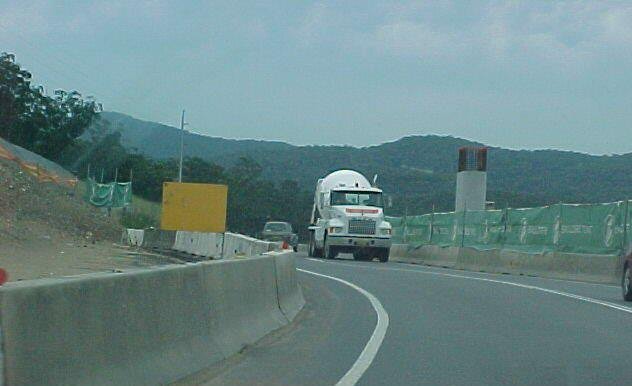 The approximate area of today’s [27-11-2011] collision. It’s a dangerous S-bend deliberately made by the RTA (now RMS, Roads & Maritime Services) and their contractor, Baulderstone Pty Ltd.
It’s been reported that when on this section of the S-bend it can appear that southbound vehicles are travelling in the northbound lane.
This is the first (publicly known) major accident to occur because RMS (then RTA) KNOWINGLY and DELIBERATELY chose the dangerous Option E route instead of the cheaper and safer (refer Value Management Workshop Report) western Option A (or variation).
RMS and ALL MPs and others who pushed for the dangerous Option E route contributed to this tragedy.
______________________________
