‘THERE ARE RISKS TO DRIVERS on the proposed Upgrade, AND TO RESIDENTS of Bulahdelah associated with boulders falling from the cliffs and slopes upslope from the proposed Upgrade’.
‘THERE ARE ALSO RISKS OF SLOPE FAILURE of the colluvial material [“ancient landslide” (already-occurred landslide/s) materials of “silty-clay-sand-gravel”] DURING both CONSTRUCTION AND the OPERATION of the proposal’.
Ref – both of the above – the NSW Roads and Traffic Authority [RTA]: EIS Main Vol. 8.2.5. [Note added 2-11-2011: the current Minister for Roads, Duncan Gay, has renamed the RTA. It is now Roads & Maritime Services.]
THE WESTERN OPTION A DOES NOT HAVE ANY OF THESE RISKS.
Sourced from: Save the Alum Sacred Mountain Petition – submission by STOP THESE-MURDERS.
– – – – – – – – – – – – – – – – – – – – – – – –
The area of ‘ancient landslide’ was described in the Bulahdelah Upgrading the Pacific Highway Environmental Impact Statement (EIS) as: a substantial zone of unstable ground (colluvium):- Extract from Page 3-11 Technical Paper 4 EIS Volume 3
The Easter Weekend landslide of 21st March, 2008, SR-87, Gila County, Arizona, occurred in ‘wet, clay-rich to sandy sediments that are part of a larger ancient (paleo) landslide deposit‘. Ref: Arizona Geological Survey Summary: “Reconnaissance Report on the Easter Weekend Landslide of 21 March 2008, SR-87, Gila County, Arizona.” by M. Diaz, B. Gootee and A. Youberg.
Extract from Page S.27 of the EIS Summary:
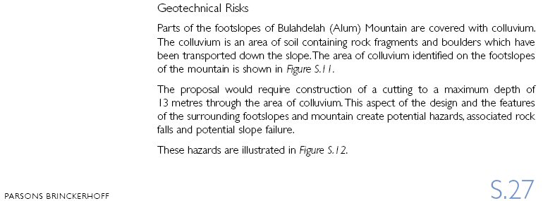
Geotechnical Risks [emphasis added]
Parts of the footslopes of Bulahdelah (Alum) Mountain are covered with colluvium [landslide materials]. The colluvium is an area of soil containing rock fragments and boulders which have been transported down the slope [in a landslide or landslides]. The area of colluviums identified on the footslopes [mid-slopes] of the mountain is shown in Figure S.11.
The proposal would require construction of a cutting to a maximum depth of 13 metres through the area of colluvium [landslide/s]. This aspect of the design and the features of the surrounding footslopes and mountain create potential hazards, associated rock falls and potential slope failure. …
– – – – – – – – – – – – – – – – – – – – – – – –
Some of the information contained in the following has been acquired from: About the Bulahdelah Bypass – the Facts!
A bypass is: ‘a road enabling motorists to avoid towns and any other heavy traffic points or any obstruction to easy travel on a main road’. (Ref: the Macquarie Dictionary.)
The route the RTA intends to use for the Pacific Highway ‘upgrade’ at Bulahdelah, Option E, is not, in any sense whatsoever, a bypass.
Option E would not have a through-speed of 110 km per hour:-
The speed limit for all traffic would lower from 110 to 100 km per hour at the crest of a hill where northbound laden trucks would be slowed by approximately 25 km per hour over a distance of 900 metres and southbound laden trucks would be slowed by 20 km per hour over a distance of one kilometre. (Ref: Bulahdelah Upgrading the Pacific Highway Environmental Impact Statement – EIS – Volume 3 Technical Paper 4.)
Note: while the slowing of northbound trucks was counted in the EIS as an upgrade objective failure, the slowing of southbound trucks was not.
The RTA document, the Value Management Workshop Report, provides further evidence that Option E is not the safest option for road users. In said report it is shown that, based on traffic-flow alone, Option A (to the near-west of Bulahdelah) is the safest.
There are additional hazards in that:-
A section of Option E would be located within the mid-slopes of a 292 metres high mountain, the Alum Mountain, which is [bold and red typeface added for emphasis] ‘particularly prone to mass movement [landslides] and rockfall [boulder falls]’. (Ref: Soil Landscapes of the Dungog 1:100 000 Sheet – Department of Land and Water Conservation, Sydney. L.E. Henderson, 2000.)
Part of the roadway would be located in (13 metres below the surface of) an existent landslide estimated by the RTA as being some 25 metres deep. (Ref: the EIS.)
The RTA-‘inferred’ area of the existent (already-occurred) 25 (twenty five) metres deep landslide is outlined in red (ref: EIS Main Volume)
The RTA’s own records show that the RTA was aware of the existent landslide during the route selection stage. (Ref: EIS Volume 6 Technical Paper 11 page 2-14.)
According to the RTA’s own records, they failed to fully investigate the already-occurred landslide of which they were aware ‘during the route selection stage’.
As per the above RTA record: The RTA made Option E the ‘preferred option’ knowing of the existence of already-occurred landslide materials (‘colluvium’) and without determining their full extent.
The route selection stage concluded with the Value Management Workshop (VMW – 29th & 30th August, 2000). The existent landslide/s, the hazards of further landslides, boulder falls, batter collapse and other relevant hazards were not evaluated at the VMW. (Further information is available at the Value Management Workshop Report page of this site.)
In EIS Volume 6 Technical Paper 11 [e.g. Figure 2.1] and in June, 2008, the RTA published another version of the landslide, showing it as extending both north and south of the EIS Main Volume representation.
In this rendition, an area of existent landslide is illustrated as being over half as wide as the section of township above which it is located. (This area of landslide would be blasted for ‘cuts’ 3 and 4.)
This version also shows existent landslide at Lee Street, where blasting would take place during construction of the northern interchange.
 The existent landslide as illustrated in EIS Volume 6 Technical Paper 11 (*Figures 2.1 & 2.2) and the RTA document June 2008 Bulahdelah Upgrade: geotechnical aspects – page 3 (locations of Scott Street and the public school are added)
*Figures 2.1 Geotechnical Terrain Map & 2.2 Geological Map were produced through mere ‘walkover surveys of the study area’. Ref: RTA record 2.3 Geological Mapping EIS Volume 6 Technical Paper 11 page 2-2
– – – – – – – – – – – – – – – – – – – – – – – – – – – –
Despite the existence of this already-occurred landslide, the environmental impact statement’s ‘Landslide Risk Assessment’ contained no assessment whatsoever of the risks of landslides from the mountain’s upper regions.

4.3.1 Landslide Risk Assessment [from EIS Volume 6 Technical Paper 11 Page 4-7]
The report on Colluvium Area (Cut 4) Stability (Parsons Brinckerhoff 2004a) considered that the proposed cutting through the colluvium presented the following potential hazards for the proposed Upgrade and adjacent houses:
Hazard A: Boulder falls from the cliff face or natural hillside slope above Cut 4;
Hazard B: Gravels, cobbles or boulders released from and rolling down the cut face;
Hazard C: Small scale ‘shallow slump’ failure of the cut face;
Hazard D: Large scale overall slope failure by slippage along the colluvial/bedrock or natural soil interface and daylighting near the toe of Cut 4; and
Hazard E: Large scale overall slope failure encompassing the entire road. The failure surface is the same as Hazard D, but runs beneath the roadway and daylights downslope of Cut 4.
These hazards are illustrated on Figure 4.5. [Above]
58L320A.070 11 – Topography, Geology & Soils Final.doc PARSONS BRINCKERHOFF Page 4-7
– – – – – – – – – – – – – – – – – – – – – – – – – – – –
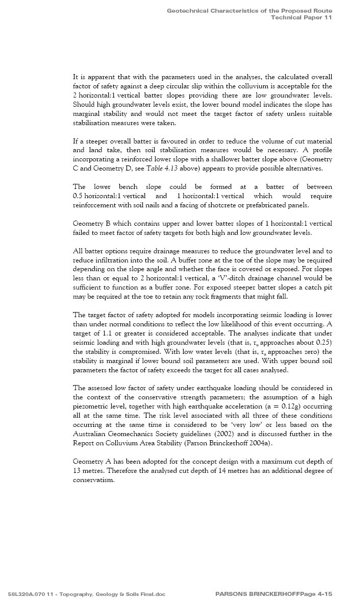
The RTA’s ‘calculated overall factor of safety against a deep circular slip [landslip i.e. landslide] within the colluvium‘ [the soils and boulders of the existent – i.e. already occurred – landslide]
The Alum Mountain is a hydro-geological seepage zone plus has massive water runoff during and after heavy rain.
From the EIS: Technical Paper 11 – Geotechnical Characteristics of the Proposed Route – page 4-15 [‘batters’ are the man-made slopes beside roads which have been located below natural ground level]:-
It is apparent that with the parameters used in the analyses, the calculated overall factor of safety against a deep circular slip [landslip i.e. landslide] within the colluvium [the existent landslide] is acceptable for the 2 horizontal:1 vertical batter slopes providing there are low groundwater levels.
Should high groundwater levels exist, the lower bound model indicates the slope has marginal stability and would not meet the target factor of safety unless suitable stabilisation measures were taken. [Underlines and bold and red typeface added for emphasis.]
Note: the RTA conducted geotechnical investigations prior to publication of the EIS. These included the installation of monitoring wells from which water-level measurements were taken. Yet, in the above extracts from the EIS, the RTA, knowing full well that there are high groundwater levels on the Alum Mountain, stated: ‘providing there are low groundwater levels‘ and ‘should high groundwater levels exist‘.
Water runoff on the Alum Mountain, Bulahdelah, 16th May, 2003
Kerry Navin visited the courthouse [where the historical society is located] during the very early stages to obtain information about heritage. She told me, “They won’t put it there [through the Alum Mountain]. There’s too much water runoff.”
Malcolm Carrall, Archives Officer, Bulahdelah & Districts Historical Society
Note: Kerry Navin is a co-director of the firm Navin Officer Heritage Consultants Pty Ltd. Information on affiliations of Kerry Navin is available at the Wall of Shame – under construction page of this site.
– – – – – – – – – – – – – – – – – – – –
NOTE (inserted 22-6-2010): From EIS Volume 6 Technical Paper 8 – 4.2.2 Groundwater Potential Impacts [bold and red typeface added for emphasis]:-
Following completion, the proposal has the potential to affect groundwater resources in the following ways:
-
watertable levels may change, affecting soil stability, especially in colluvium [existent landslide] areas …
– – – – – – – – – – – – – – – – – – – –
Inserted 26-10-2010: Extracts from page 4-34 Volume 6 Bulahdelah Upgrading the Pacific Highway Environmental Impact Statement Technical Paper 11 [Emphasis added]:-
-
4.11.1 Hill crests and ridges
The NSW Soil Data System indicates that there are four soil profiles within this terrain unit for erosion hazard. Two of these have been rated with a very high erosion hazard, one of the other profiles is rated as moderate and one is slight.
-
4.11.5 Management
One-third of the preferred route is in the alluvial plains terrain unit (with backswamp and backplain contact west of the river). The northern two-thirds comprise slopes and hill crests and ridges terrain units. The NSW Soil Data System profiles within the alluvial plains and slopes terrain units have a slight erosion hazard. The backswamps and backplains and hill crests and ridges units contain soil profiles rated with high and very high erosion hazards.
Areas of more sandy soils are potentially more susceptible to erosion. In areas of cut, the exposed batter after construction is generally expected to comprise extremely to highly weathered sedimentary rock, interbedded with clay seams. Such material will be susceptible to erosion.
– – – – – – – – – – – – – – – – – – – – – – – – – – – –
The mountain’s cliffs are of acid-producing, porous rock. From the RTA document Geotechnical Issues for Community Information which was published in the year 2000 [despite the document’s title, said issues were withheld from the public]:-
A small group of Rhyolite irregularly shaped boulders up to 6 metres in diameter was observed at the base of the mid-slopes below and west of the Alum Mountain peak. These rocks are on the eastern edge of the power transmission easement and approximately 50 metres east of the Jackson Street interchange. [The Jackson Street interchange is the long-abandoned central interchange.] These boulders are thought to have originated from the peak of [the] Alum Mountain, directly upslope from their current position.
These rocks are an indicator of previous rock face instability, which could potentially impact future route development in this area.
Further examination of Option E will require careful mapping and an assessment of risk of the instability for the cliffs at the peak of [the] Alum Mountain. Risk reduction measures may include cliff stabilisation works, re-alignment of the route and construction of protective mounds’.
The RTA’s own documentation shows that Option E would cause crash rates to increase significantly [the following information contains some repetition regarding the slowing of north- and south-bound laden trucks and the RTA’s claim in regard to use of a third lane within the median strip]:-
From the RTA document Bulahdelah Upgrading the Pacific Highway Environmental Impact Statement (EIS) – Volume 3 Technical Paper 6 – Pages A-1 – A-6 – A2 Methodology:-
Studies … show [that] crash rates increase significantly when truck speed reduction exceeds 15 kilometres per hour.
From the EIS – Main Volume 8.2.5. Design, Engineering and Constructability:-
Between Bombah Point Road and the mountain access track near Mountain Park: The new highway would climb at approximately 3 percent over 900 metres, creating speed reductions of approximately 25 kilometres per hour for laden trucks in the northbound direction.
_ _ _ _ _ _ _ _ _ _
From the EIS – Volume 3 Technical Paper 4 – 4.3.3 Northern Section (Northern Interchange to Northern End):-
The highway alignment would follow a long sweeping curve (1,750-metre radius) north from the water reservoirs to Frys Creek, crossing just to the western side of the existing highway opposite Bulahdelah Golf Course. The vertical alignment would crest and then grade down at approximately 2.5 percent for 1 kilometre to Frys Creek.
This grade would cause a speed reduction of approximately 20 kilometres per hour for laden southbound trucks. [From the EIS – Volume 3 Technical Paper 6 – Pages A-1 – A-6 – A2 Methodology: Studies … show [that] crash rates increase significantly when truck speed reduction exceeds 15 kilometres per hour.]
_ _ _ _ _ _ _ _ _ _
From the EIS – Volume 3 Technical Paper 6 (pages A-1 – A-6), the Option E hill, which would slow northbound laden trucks by approximately 25 km per hour over a distance of 900 metres, should have a northbound climbing lane.
The RTA used the American Association of State Highway and Transportation Officials (AASHTO) – Geometric Design of Highways and Streets for this assessment which, on four counts, concluded ‘a climbing lane is warranted’.
In said referenced documentation the RTA states [bold and red typeface added for emphasis]: ‘AASHTO’s recommendation is based on studies which show [that] crash rates increase significantly when truck speed reduction exceeds 15 kilometres per hour.’
The RTA, however, made the following determination [added comment in red, in square brackets]: ‘Assessment of the provision of a climbing lane on the western side of the northbound carriageway found that the additional environmental impacts and engineering costs made it less favourable than a third lane within the median over the length of this climb, subject to road safety or traffic records demonstrating a need [i.e. subject to the number of accidents/deaths], some years after opening.’
From EIS Volume 3 Technical Paper 4 4.1 – Engineering Design Criteria for the Concept Design:-
Table 4.2: Typical Cross-section Dimensions for New Highways
Feature Dimension
Four Lane Configuration
Traffic lanes 3.5 metres
Desirable median width (lane line to lane line) 15.0 metres
Minimum median width (lane line to lane line) 11.0 metres
Paved left shoulder 2.5 metres
Paved median shoulder (without safety barrier) 0.5 metres
Six Lane Configuration
Traffic lanes 3.5 metres
Desirable median width (lane line to lane line) 8.0 metres
Minimum median width (lane line to lane line) 4.0 metres
Option E’s median strip width has been reduced from 14 metres (the figure provided by the RTA during the route selection stage – ref. RTA Newsletter 2) to 11 metres.
In 2000, the RTA’s stated expectation was that, in rural areas such as Bulahdelah, dual carriageways would be capable of catering for Pacific Highway traffic volumes for a minimum of 20 years. Option E’s 11 metres of median strip are intended to cater for a future two lanes of traffic volume (a third lane within the median strip for both northbound and southbound traffic). (Ref: EIS Volume 3 Technical Paper 4 – 4.1 Engineering Design Criteria for the Concept Design 4.1.1 Road Geometry and Capacity) Construction of said two lanes would leave the minimum six lane configuration median width of 4 metres. Being the minimum width, 4 metres is insufficient to provide for a further additional lane within the median.
Even if a climbing lane were to (eventually) be put in place via construction of a third lane within the median strip, as traffic volume increases dictated a need for a third lane of free-flow speed the same as the posted speed limit crash rates would escalate.

The hill where ‘crash rates would increase’ due to no climbing lanes.
[Note: this paragraph updated 13-9-2010] Although some pre-construction, including surface clearing and a 750 metre long section of new power line easement, has taken place, actual construction of Option E has not yet begun. RTA documentation shows that ‘major construction’ would be over to well over $300 million ($315 million according to David Borger, current NSW Minister for Roads).
Expenditure has already been made on detailed geotechnical and other studies of Option A.
Some 1.5 kilometres of partially constructed roadway to the south of Booral Road (which is to the south of the Myall River) can be equally applied to the geotechnically easier, cheaper and safer Option A.
Property acquisitions which the RTA has made on the western side of the current section of Pacific Highway can also be utilised for Option A.
(28-10-2009)
– – – – – – – – – – – – – – – – – – – – – – – – – – – –
For the benefit of those who, if the RTA’s use of Option E for the ‘Bulahdelah Bypass’ is not prevented, will be placed in the position of needing to consider litigation:-
Murder shall be taken to have been committed where the act of the accused, or thing by him or her omitted to be done, causing the death charged, was done or omitted with reckless indifference to human life, or with intent to kill or inflict grievous bodily harm upon some person, or done in an attempt to commit, or during or immediately after the commission, by the accused, or some accomplice with him or her, of a crime punishable by imprisonment for life or for 25 years. Ref: Crimes Act 1900 – Murder and manslaughter defined Section 18 (1) (a) [bold & red typeface added for emphasis]
– – – – – – – – – – – – – – – – – – – – – – – – – – – –
Causes of Landslides [as relevant to the use of the Alum Mountain, Bulahdelah, for road construction (Option E) as planned by the NSW Roads and Traffic Authority (RTA).] (Ref: The Australian Government Geoscience Australia [accessed 5th February, 2010 – bold and red typeface added for emphasis])
Natural Causes [include but are not limited to]:
- Elevation of pore water pressure by saturation of slope material from either intense or prolonged rainfall and seepage.
- Vibrations caused by earthquakes.
Human Causes [All of (but not limited to) the following are included in the RTA’s Option E plan]:
- Removal of vegetation.
- Interference with, or changes to, natural drainage.
- Modification of slopes by construction of roads…
- Mining and quarrying activities.
- Excavation or displacement of rocks.
- Vibrations from blasting.
- Vibrations from heavy traffic.
Note (added 6-10-2010 – information outsourced): In September, 2003, and August, 2009, Rural Fire Service volunteers from the Bulahdelah area deliberately lit fires along the (then) power line easement on the lower mid-slopes of the Alum Mountain. Said fires have caused substantial thinning of the mountain’s forest (i.e. removal of vegetation). [Additional information in regard to said fires and Rural Fire Services, Bulahdelah, is available under Bypassing Bulahdelah at the Podcasts/Transcripts of Interviews page of this site. Said page also contains documentation in regard to an incident at Bulahdelah on 20th September, 2009, in which ‘a gang of thugs, some wearing RFS (Rural Fire Services) yellow trousers, perpetrated violent assaults on property and on persons’.]
– – – – – – – – – – – – – – – – – – – – – – – – – – – –
Landslide Example
On 13th January, 2001, an (off the El Salvador coast) earthquake measuring 7.6 on the Richter Scale triggered a landslide in Las Colinas, Santa Tecla, San Salvador. Five hundred and eighty five people were killed.
The hillside had been [the] subject of a high-profile environmental battle waged against real-estate development by city officials, environmentalists and local residents, who charged that the hillside had been weakened in the past year by the residential developments.
“The site . . . was completely inappropriate, because it was inherently geologically unstable,” said Jose Perez, a geologist who has carried out studies of the area for the city and national governments.
Those liars and thieves didn’t listen when we warned this would happen. Damn them to hell. Damn them.
Afredo Rodriguez, Quake Victim, speaking of how developers ignored the warnings of environmentalists.
– – – – – – – – – – – – – – – – – – – – – – – – – – – –
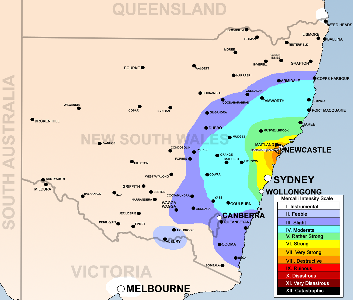
Earthquakes at/in the area of Bulahdelah
Monday, 19th July, 1949 [1.00 a.m.]: a violent earth tremor shook the town. ‘Residents ran into the streets when their houses began to rock crazily’.

Above image: Canberra Times news article about the Bulahdelah earthquake of Monday, 19th July, 1949
Thursday, 28th December, 1989 [10.27 a.m.]: an earthquake measuring 5.6 on the Richter scale occurred at Newcastle. Bulahdelah is within the zone map.
September, 2007 – an earth tremor occurred at Bulahdelah on 18th, 19th or 20th of said month. (Information presented by Bulahdelah resident.)
Saturday, 9th August, 2009, [just prior to midday]: an earthquake measuring 3.6 on the Richter scale occurred 50 kilometres offshore from Forster. [Paragraphs 11 to 13 on linked page.]
Friday, 12th March, 2010 [3.30 a.m.]: an earthquake measuring 3.4 on the Richter scale occurred 80 kilometres offshore from Forster. Bulahdelah is within the zone map.
– – – – – – – – – – – – – – – – – – – – – – – – – – – –
Exacerbating the already high risk of landslides: the Alum Mountain was frequently shaken by blasting during the mining era
Extract from the Dungog Chronicle 24th June, 1904:-
… Blasting has frequently to be resorted to, and it is indeed a splendid sight to see the mountain shaken, and huge stones thrown into the air, to fall crashing down the mountain sides. …
– – – – – – – – – – – – – – – – – – – – – – – – – – – –
Risk of settlement continuing beyond the construction period
From EIS Volume 6 Technical Paper 11 4.6 Embankments [emphasis added]
4.6.1 Settlement Assessment in Fills
Settlement along the fills can be critical where embankments are constructed on soft compressible soils and there is a risk that primary consolidation settlement would continue beyond the construction period. Combined with secondary (creep) consolidation of the soft soils and internal creep of the fill material itself, settlement has the potential to exceed design criteria, particularly between structures and adjoining embankments.
Critical settlement locations were identified at structures, at maximum fill embankment height and/or at soft soil foundations. In all locations except at the northern interchange, the maximum fill height and critical foundation soils occurred at a structure.
At the northern interchange the maximum approach embankment heights are not located at the overpass bridges.
Settlement is expected to be most critical at the Myall River Bridge where embankments are high and soft soil was encountered to depths of 4.7 metres at borehole locations.
The adopted performance criteria for evaluating settlements have been based on that [sic] adopted for recent Pacific Highway Upgrade Projects such as Yelgun to Chinderah, and *Lane Cove Tunnel.
*A section of the Lane Cove Tunnel collapsed in the early hours of2nd November, 2005. According to the Executive Summary (page 4) of the WorkCover Report into the Lane Cove Tunnel Collapse and Subsidence (March, 2006) Contributing Factors included (but were not limited to) the geological conditions at the site.
[Sourced from: Pacific Highway – NSW Government’s Killer Act updates – The Company Employed [as ‘consultants’] by the RTA for the Pacific Highway, Bulahdelah, Project – publication date 2-10-2008]
– – – – – – – – – – – – – – – – – – – – – – – – – – – –
 The southern interchange is to be located on a bend. This was disguised in the EIS representation of Horizontal Alignment Figure 4.2c. [Composite of Horizontal Alignment Figures 4.2a, 4.2b, 4.2c (amended) and 4.2d – EIS Volume 3 Technical Paper 4.]
 Photograph shows the dangerous bends that are in this construction. Shown are the southern interchange and the twin bridges. This is not improving safety. Photograph (taken from the southern top peak of Bulahdelah – the Alum – Mountain Wednesday 4th July, 2012) & description (emphasis added) sourced at Save the Alum Sacred Mountain, Bulahdelah. Republished with permission.
____________________________
Note added 1-12-2011: Completion of this dangerous route is not due until August, 2013 – weather permitting. The first fatality has occurred during construction.
At approximately 3.00 p.m.on Sunday, 27th November, 2011, a Nissan sedan and a semi-trailer collided head-on on the Pacific Highway immediately north of Bulahdelah.
The collision occurred on a section of roadway where unsafe bends have been constructed during the Roads & Maritime Services (RMS, formerly RTA) and Baulderstone Pty Ltd ‘upgrading’ process.
The driver of the sedan died at the scene.
The following comments are from Save the Alum Sacred Mountain, Bulahdelah. They are republished here with permission. Emphasis has been added.
This is a photograph of the approximate area of today’s collision. It’s a dangerous S-bend deliberately made by the RTA (now RMS, Roads & Maritime Services) and their contractor, Baulderstone Pty Ltd.
It’s been reported that when on[/approaching] this section of the S-bend it can appear that southbound vehicles are travelling in the northbound lane.
This is the first (publicly known) major accident to occur because RMS (then RTA) KNOWINGLY and DELIBERATELY chose the dangerous Option E route instead of the cheaper and safer (refer Value Management Workshop Report) western Option A (or variation).
RMS and ALL MPs and others who pushed for the dangerous Option E route contributed to this tragedy.
____________________________
New Power Poles add to Risks
From the RTA document Bulahdelah Upgrading the Pacific Highway Environmental Impact Statement – Main Volume 8.2.5. Design, Engineering and Constructability:-
There are also risks of slope failure of the *colluvial material during both construction and the operation of the proposal.
*‘Colluvial material’ is the term used by the RTA for the boulder-strewn ‘silty’ [sic] clays, sands and gravels of the massive already-occurred landslide – or, as indicated by the RTA’s use of ‘silty’, the already-occurred mudslide – in the path of Option E.
 Typical landslide (or mudslide) materials in the area of the already-occurred landslide.
Concrete power poles have now been located – at least two in tilted positions – in and near the already-occurred landslide (or mudslide) which the RTA has documented as having ‘risks [note: plural] of slope failure during both construction and the operation of the proposal’.

A concrete power pole being erected in the ‘colluvial’ (already-occurred landslide or mudslide) zone
(4-11-2009)
_______________________________
 The leaning power-pole in the background of the above photograph is one of those installed by TransGrid in late 2009. It is within the area of the existent landslide.
(Photograph originally published at Save the Alum Sacred Mountain, Bulahdelah on 10-2-2010. It is republished here with permission.)
(11-2-2010)
_______________________________

Leave a comment